Walks and hikes in Europe and California, posted sporadically as they happen… or as I reflect on them…

Monday, December 1, 2008

How to walk across the alps

Eastside Road, Healdsburg, December 1, 2008
BACK FROM A MONTH in Italy, and revisiting this blog, I realize it'll be a little confusing to anyone seeing it for the first time.

This is an account of a walk from Evian-les-Bains to Nice, about 450 miles, done from June 20 to July 28, 2008, with my grandson Henry and my friend Mac. I've posted a day-by-day account, with photos.

Since this is a blog, though, the account shows up on the Internet in reverse order. If you want to read through the walk in the correct order, you'll have to click on August, above; then on Introduction.

One day perhaps I'll write this trip up in a more coherent manner. In the meantime, I hope this won't be too confusing, or too complicated.

One other thing: I've been trying to put more photos from the walk online, but it's a slow process. The week of July 13 is all I've managed to get on; you can find them here.

Thursday, October 23, 2008

35: Levens to Nice: end of the walk

Day 38: July 28, 2008 (walkday 34)

SUNDAY, JULY 27, we rested — our first rest day since the 12th, two weeks ago. I’d grown so used to the pace I hadn’t noticed. Books had warned a day a week’s a good idea, and so had our Austrian friend Sabine Schroll, when we talked to her in Switzerland, a month and a day ago — it seems both just last week, and years ago. The sense of time has been completely changed by this walk.
But today, Monday the 28th, was to be the last day of the walk. We would be lazy: we left our backpacks in the apartment. We had a leisurely breakfast, then walked down to the station to catch the bus back to Levens, riding a route we’d taken Saturday in the opposite direction. An interesting ride, I thought, quickly through Nice and its outlying sections, then on D19, the Route de Levens, through Les Moulins and Tourrette-Levens, past quarries and car-lots. I kept looking out the window, trying to guess where the afternoon walk would take us: hard to tell. Five weeks on trails, and I’m no better a reader of maps than when I began.
We had an early lunch in Levens, same café, same salad, same waiter who knew us, of course, and recommended his family’s hotel in the Tende if we should get over that way; and then we set out on the trail, leaving town a little before one o’clock.
P1030711.jpg
Quickly we were in the countryside, a dry, warm, teeming countryside: it’s dry, but there’s been plenty of water to push all this underbrush. We walked alongside walls containing suburban gardens, I suppose; and then through mixed forest;
IMG_0634.jpg
photo: Mac Marshall

up rocky trails through maquis; and along a dirt road on a ridge finally bringing us to the town of Aspremont, where we’d imagined there’d be a pot of tea for us, or maybe some eau minerale gazeuse for me to pour a bit of Fernet Branca into. It was not to be: the hill town itself lies off the GR5, and no one seemed enthusiastic about walking off-route. One café was on the main road our path had joined to circumvent Aspremont, but it was closed.
P1030717.jpg

We walked on, past a big construction site, then up into the maquis, dry chapparal. We’d been hearing cicadas for some time; now the sound was constant. We were walking a ridgeline, the Crête de Greus I think it is, south into the sun and toward Nice and the Mediterranean,
P1030720.jpg

down past stone walls, under pines, and out
P1030722.jpg

onto a surprising flat perched above the city of Nice, a broad prairie that must have been farmed up to a few decades ago — ruined restanques and a few ancient olive trees stood mute testimony.
P1030726.jpg

The GR5 does not actually end at the sea, though: it disappears — or at least its reassuring red-and-white balisage does — at the Carrefour de l’Aire-Saint-Michel, still 314 meters above sea level. Here there were still surprises: 5:49 pm, a parklike area, rather abandoned-looking, with trails, old walkways, sycamores.
P1030728.jpg

Six o’clock: paved road, cyclone fence, the outskirts of town. No cafés in these residential quarters: we continued walking
IMG_0642.jpg
photo: Mac Marshall


past walls and hedges, always downhill, always toward the sea.
We walked, as usual, mostly in silence, saving conversation for the rest stops, the occasional viewpoint or photo opportunity. About seven o’clock we came to the busy Place Alex-Médecin, and here on a street-corner was a pleasant-looking bar-café: time for a celebratory vin blanc next to a table of geezers who eyed us curiously. One struck up a bit of conversation: Are you Canadian? No? Not English, are you? What? Californians! Welcome to Nice; congratulations on your walk!
P1030730.jpg

At 7:45 I watched Mac enthusiastically approach the sea, Henry on his heels. We didn’t strip and run in; it was late; we were a little tired; I was a little self-conscious. There weren’t many people on the beach, but that wasn’t it; I just felt a bit let down. No question of walking further: nothing but salt water between us and Corsica, I guess.
IMG_0644.jpg
photo: Mac Marshall


Mac took a picture of Henry looking on as I looked down at my boots on the pebbles, foamy sea-water licking lazily at my toes. What a wonderful pair of shoes you’ve been; what a long way you’ve come; how kind you’ve been to me.
P1030733.jpg

Then Mac joined me at the edge of the sea where we posed for a final photo. No tripod; no self-timed possibility. Two old men, backs to the sea, captured by a fifteen-year-old boy who was finally seeing the Mediterranean up close.
IMG_0646.jpg
photo: Henry Shere


Distance walked, day 38: ca. 26 kilometers (18 miles) • Time: 6:30 • dénivelement: ca. 950 meters (3100 feet)

Monday, October 20, 2008

34: Utelle to Levens

Day 37: July 26, 2008 (walkday 33)

OUR GUIDEBOOK TOLD US today’s route would require improvisation. We were a four-hour walk from the town of Levens, where we might stay the night. Three hours further was Aspremont, another overnight possibility. Three hours beyond Aspremont would find us in Nice, the goal. (The original goal had been Menton, but that would have required 24 additional hours walking, and the choice between the two alternatives had been made yesterday, in St.-Dalmas-Valdeblore.)
IMG_0594.jpg
View from the balcony, Utelle (photo: Mac Marshall)

All this walking would be relatively flat, never reaching above 800 meters — Utelle, where we’d spent the night, was the highest point; and while there was a climb into Levens it didn’t look serious. So we took it easy this morning, taking photos from our balcony and lazing over breakfast on the terrace.
P1030652.jpg
We didn’t leave our apartment until 9:30; and even then we lazed through Utelle, a town that might have detained us more if it had been a little busier. We went to the tourist office, where we heard about the Roman inscription on someone’s doorstep — a doorstep well guarded by an attentive dog — and we bought provisions for lunch, knowing the day would be hot and dry.
P1030649.jpg

P1030653.jpg


Then we turned west, dropping to the Rio valley, crossing it on a footpath, and climbed sharply up before dropping again to the Cros valley. In a little over an hour we reached Chapelle St.-Antoine.
P1030659.jpg

Much of the walk down was through terrain apparently abandoned from agricultural use scores of years ago. The path often ran alongside ancient moss-covered stone walls, within forest perhaps surviving ancient nut groves. It then continued to drop, crossing highway D67 by hairpins on the footpath, arriving finally at the day’s lowest point, to cross both the Vesubie river and highway D2565 at Cos dUtelle: we were only 195 meters (640 feet) above sea level!
P1030660.jpg

We took only fifteen minutes to eat our lunch in a miserable spot, a bus-stop kiosk that gave a little shade: there was no café, no bar. It was so hot and oppressive that we didn’t even think to take any photographs. The constant sound of cicadas and the hot close air were fatiguing.
P1030662.jpg
An hour later, though, we climbed along the paved road, past a dump site, into the town of Levens, where we planned to spend the night. It was quarter to two and the tourist office was closed, so we decided on lunch in the center of town, reached by climbing up a long flight of steps, past one closed restaurant after another. (In truth I was self-conscious of our appearance, too: Levens seemed an upscale town, and we were hot, dirty, and sweaty.)IMG_0601.jpg
(photo: Mac Marshall)
Lunch was a delicious salad and a glass of rosé on the terrace of a café on the main intersection, with a marriage procession to entertain us. We had plenty of time to kill: the tourist office didn’t open until past three. And then and there we discovered it was true, there wasn’t a bed to be had in Levens, or in the next town, Apremont, or anywhere else in the vicinity. There was a huge horse show going on, for one thing; it was summer, for another.
There was nothing to be done but wait another hour or so and then take the bus to Nice, where we knew an apartment was waiting for our use. We arrived about seven, were met at the bus station, and whisked to our flat, airy and newly painted and very convienently located, a couple of blocks from that elusive Mediterranean.

Distance walked, day 37: ca. 12 kilometers (7.5 miles) • Time: 4 hours• dénivelement: ca. 1400 meters (4600 feet)

Friday, October 17, 2008

33: St.-Dalmas-Valdeblore to Utelle

Day 37: July 26, 2008 (walkday 33)

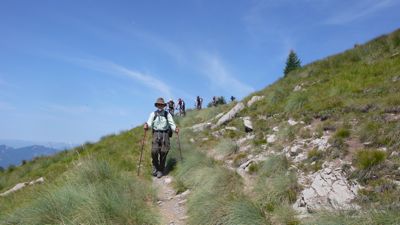
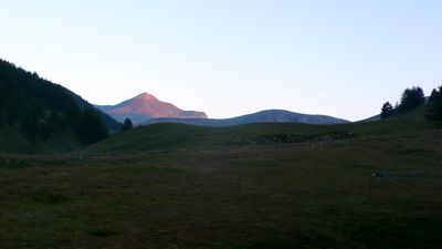
I LOOKED AT THE GUIDEBOOK at breakfast, as usual: another really long day, one of the longest of the trip. The profile shows a steady climb in the morning, to our last high col at nearly 2000 meters (6500 feet); then a steady descent in the afternoon to Utelle at 821 meters, with only a teeny bump up for variety. It’s a long day because there’s no place to stay before Utelle: and even that was problematic, but I found one hotel with a vacancy. A long day, but no problem for me; altitude won’t be a problem. Heat may be. But my feet haven’t given me any trouble and my back and legs are strong.
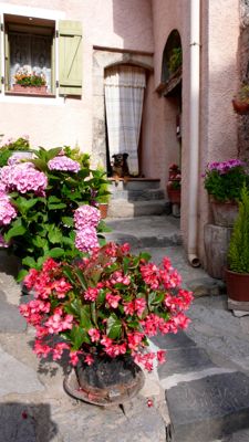
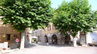
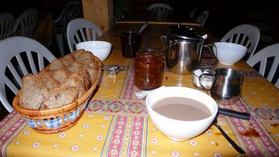
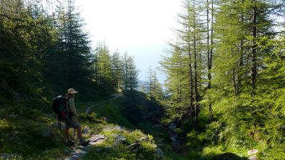
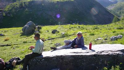
We left about 8:45, after buying provisions at the local grocery — dried apricots, a can of juice, bread, salami. There won’t be any place to provision on the trail. We began with a steady climb up 400 meters or so to our first col, the Col du Varaire,
P1030563.jpg

arriving only fifteen minutes behind the time allotted in our guidebook: very encouraging. Even better, we reached the Col du Caire Gros, two hundred meters higher, ten minutes ahead of schedule.
P1030571.jpg
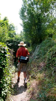
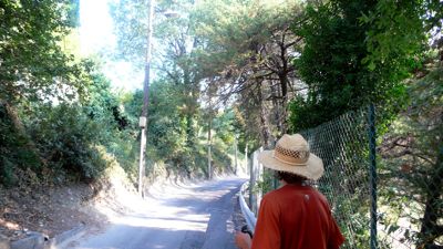
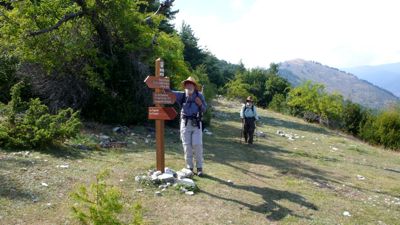
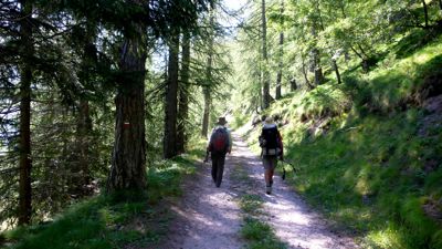
Mac pursued by trail bikes

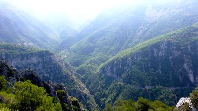
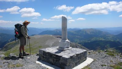
A short rest before tackling the easy traverse to our next goals, both reached on schedule. Twelve noon; the Baisse de la Combe; and then forty minutes later we were on the Collet des Trous, the day’s highest point, the last height of our walk at 1982 meters, 6500 feet.
P1030586.jpg
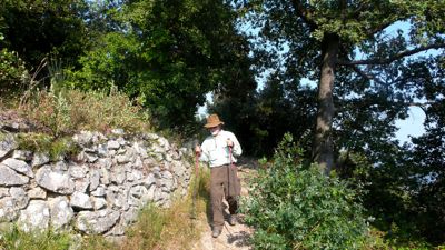
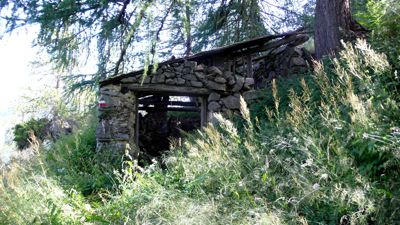
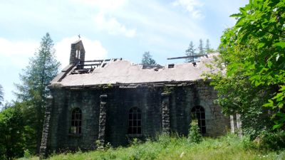
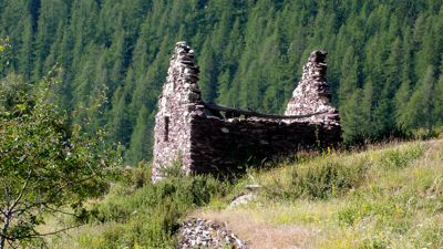
Ruined church, Granges de la Brasque

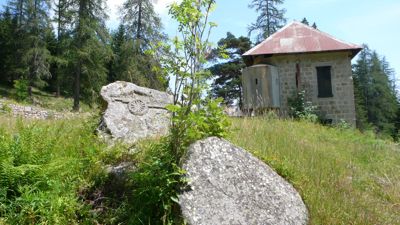
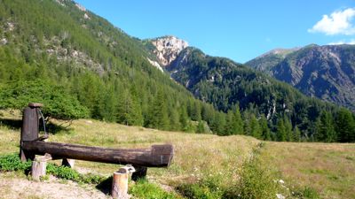
On from there to the Granges de la Brasque, stopping just before reaching it for a half hour for our picnic lunch. Formerly it was a military camp, du Tournairet; and there were some interesting things there to see.
P1030589.jpg
20th c. pillbox glued to corner of older stone barracks
(note relief of caisson on granite stone)

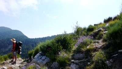
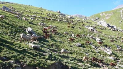
Less than an hour later we were at the Col d’Andrion, and beginning to wonder just why so many cols were needed on this stage of our walk. A “col,” to answers.com, is a “pass between two mountain peaks or a gap in a ridge. [French, from Old French, neck, from Latin collum.]” Problem today is, we’re walking on pretty even terrain for a number of kilometers, along a ridge; cols and collets come thick and fast.
P1030602.jpg

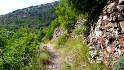
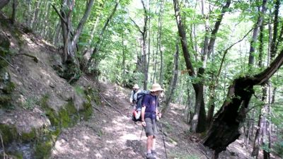
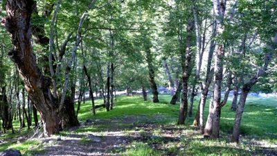
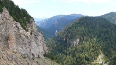
From the military camp we walked along a paved road for D332 again, for quite a while; then turned into forest again to drop to yet another gap, theCol des Fournès, and then an hour lager the Col de Grateloup — “scratch-the wolf”: where do the French get these names, anyway?
P1030609.jpg

P1030630.jpg
We know there was a dramatic turn or two yet to come: first, the Brèche du Brec, the “breach of the Brec,” the Brec being a major upthrust on the ridge running southerly toward Utelle. The terrain now was unforgingly Provençal, southern, dry, almost arid. One guidebook, Walking Europe from Top to Bottom, even warned against venemous snakes, and in fact we did see a viper or two on the trail.
P1030634.jpg

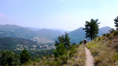
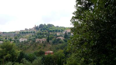
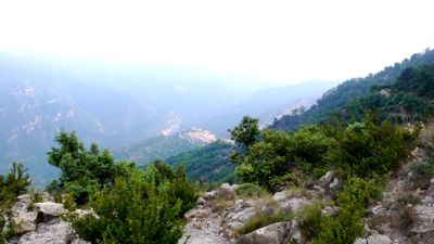
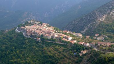
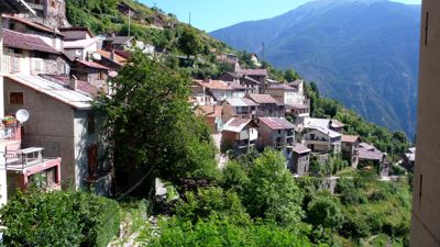
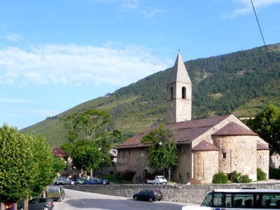
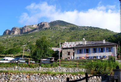
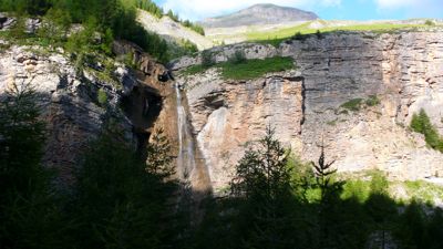
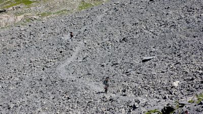
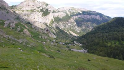
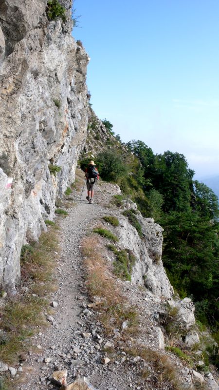
The pass itself was remarkable, one of the truly memorable events of the entire five-week walk: at a couple of points cables assisted, handrail-wise, in getting past spots that may have fallen away. A sudden climb took us to a thumb of rock from which we looked down onto the plateau town of Utelle, a sort of island of stone placed at the meeting-point of five or six distinct valle¥s leading away like spokes on a wheel. Some of these valleys lead in turn to important mountain passes: this must have been strategic territory for millenia.
P1030636.jpg

The descent from the Brèche was fairly steep: seven hundred meters in six kilometers or so, down dry and loose terrain though on well-defined trails. By now one of us was limping, walking very carefully. I asked Henry to go on ahead: it was getting late, and I was afraid the hotel restaurant would be closed before we got there. I knew, too, that at seven o’clock much commerce would be finished for the day.
P1030641.jpg

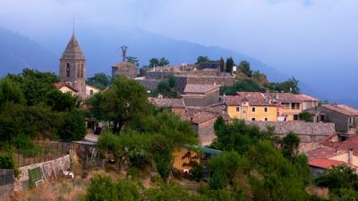
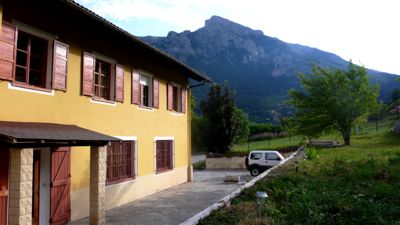
Mac and I arrived at the hotel about 7:30, surprised to find that it was empty. It was in fact not a hotel at all but a vacation apartment building, renting out complete apartments, with kitchens and all, by the week. We’d get an apartment for the week, but there was no restaurant, and there was nothing in town. My 1985 French encyclopedia tells me the population of Utelle is 398; Wikipedia raises that figure (as of 1999) to 488. Clearly the city could house more, though probably not support them.
The hotel guy, or apartment super, or whatever he was, rustled up some food for us: three orders of salmon steak; three rissoles (molded rice side dishes); three crèmes caramels; a bottle or two of rosé. There was a microwave oven in our kitchen, so we made do. There was also a balcony looking out toward the south, toward Nice. We relaxed after our showers and dinner, talking about the walk, making plans for Nice, a day or two away.

Distance walked, day 37: ca. 29 kilometers (18 miles) • Time: 10:30 • dénivelement: ca. 2580 meters (8465 feet)

Thursday, October 16, 2008

32: Vacherie de Roure to St.-Dalmas-Valdeblore

Day 35: July 24, 2008 (walkday 31)


Up early this morning, six o’clock, and out to look at the morning. As I wrote some years ago:

Already in my shorts, I rise
To verify the morning skies
P1030485.jpg

(though in fact I did not, do not, sleep in underwear, not that you care).
P1030497.jpg

The morning was delicious: pink light on the distant Mont Démant; cows coming in to be milked at the vacherie. I had time to look at today’s étape in the guidebook: it will be a long day, taking us to the lowest elevation we’ll have seen since we left Lake Geneva. At seven, the usual breakfast: bread, butter, café au lait, with nice homemade jam at this refuge.
P1030503.jpg


Then, a few minutes past eight, out into the day, another clear one promising warm weather. We walked down the Longon valley, continuing the pleasant walk that had ended yesterday’s stage. We passed the ruins of the vacherie that had preceded last night’s refuge: it had been destroyed by an avalanche, a reminder that these peaceful pastures have a very different personality in winter.

P1030511.jpg

P1030513.jpg


In an hour we’d dropped 400 meters and arrived at Rouglos, where a trough suggested we take a break, and a roofless refuge made me think again of the weight of accumulated snows. Then it was

P1030516.jpg


on again down a country road, practicising our French R’s with Rrrrourrre and Rrrouglos. We were traversing for the most part, crossing little streams from time to time, walking through the Fracha forest, ultimately reaching the paved road D130, banked with red stone, skirting an arboretum I wished we’d had time to visit, down toward the village of Roure, a pretty town improbably holding a steep hillside.
P1030531.jpg

GR5 became a footpath skirting houses and walled gardens, often with lavender, figs, and fruit trees reminding us that we were considerably lower: Roure is at 1100 meters. We peeked into a small chapel,
P1030525.jpg

then continued into town looking for a café, finding it, enjoying a pot of tea.
And then it was time for a serious descent, down 600 meters in an hour and a half to the banks of the Tinée, where a real restaurant provided a lunch stop across the street from a handsome old building, formerly the fish-hatchery, now converted to some other use...
IMG_0583.jpg
photo: Mac Marshall

Leaving St.-Sauveur-sur-Tinée we took one of our false turns and had to retrace a kilometer or so along the paved road, finally finding a GR5 blaze just a few meters from the restaurant where we’d lunched. From there it was a climb, and I found myself often confused by the terrain, the direction, even the light. After all those days in the mountains we were now walking in quite different country, and the local economy was clearly different; herding and farming had given way to some kind of urban-based economy; houses were more frequent but apparently either for weekend and vacation leisure use or shelter from a commute-enabled occupation in town.
P1030549.jpg

There was Rimplas, for example, where we stopped for a mineral water on the terrace of the town grocery-cum-café. Another hill town, rather like an Italian hill town in Liguria, say, Rimplas seemed utterly deserted on this warm late afternoon. We saw a few old people, people my age I mean; no children, no workers.
P1030551.jpg

We took to the trail again, descending gently now to the hamlet of La Bolline, and then walked rather a disagreeable stretch, often alongside paved roads, through what seemed to be suburbs of Saint-Dalmas-Valdeblore. On and on the road took us, past fenced-off yards surrounding vacation homes and condos, until finally we came to the old village itself, considerably higher than the newer one down in the valley.
P1030558.jpg

A fine old romanesque church from the 11th century stood at the upper end of town, close to our gîte d’étape, “Les Marmottes” — that and Les Glaciers were the names of perhaps a quarter of the places we’ve slept in this last five weeks.
Here, since we're nearing Nice, we were served a good dinner, good and somewhat nissard: a cheese feuilleté, a salt-water fish called colin unfamiliar to me, white rice with pistou, and a green salad. We had a room to ourselves here, shower and toilet down the hall, and slept well.
P1030556.jpg


Distance walked, day 35: ca. 27 kilometers (17 miles) • Time: 10:30 • dénivelement: ca. 2750 meters (9040 feet)

Tuesday, October 14, 2008

31: Roya to Vacherie de Roure

Day 34: July 23, 2008 (walkday 30)

P1030356.jpg
Today’s walk was an easy one: 13 miles in about nine hours, with about a mile of dénivelement, elevation change, over two cols. And it was a glorious one: clear, breezy weather, endless vistas, changes of terrain. But psychologically it was difficult: we’re near the end of our Long Walk, and a little regret is setting in; I’d like this to go on forever.
P1030357.jpg

We said goodbye to our Montréal-run gîte d’étape after the usual breakfast and set out a little past eight o’clock, down a park-like river valley, past stone cabins and ruins, soon entering the Mercantour national park without really realizing it. The trail was rising, almost imperceptibly at first, past limestone cliffs with here and there a waterfall.
P1030364.jpg

My guidebook suggested it would be four hours from Roya to our first high col, but we took five and a half. The Saillevieille valley was warm and pleasant, with warm flat stones here and there to rest on,

P1030374.jpg
Mac and me, resting


but at the southern end of the valley the trail began to climb more steadily, the terrain grew rockier, the air more fragrant of sheep, goats, and donkeys,
P1030385.jpg

contrasting with odd miniature alpine rock-gardens growing apparently of their own volition.
P1030389.jpg

We climbed up a scree bank by a series of lacets, heading east now toward the ridge, where we rested and admired the view while Henry scampered up to the right to try for a glimpse of the Mediterranean. The view was extensive, but he was disappointed; I think it cannot yet be seen from this height and distance,
P1030420.jpg


From here it was an hour’s work to descend to a replat, a natural terrace on the shoulder, and then climb again, this time to a more definitive col, de Crousette, marked curiously by a broken Roman marble column dedicated to the memory of Lt. Vallette-Viallard, who died here in January 1938, if I read the inscription accurately.
P1030449.jpg
Henry at the stele

The view from this col was extraordinary; remembering that my little Panasonic camera can take movies of a sort, I took a shaky panorama of 360° — but again we were disappointed not to see the Mediterranean, now only three or four days distant.

Had we time we could have taken an hour’s side trip and climbed to the last nearby high Alp, Mt. Mounier, 2817 meters (9250 feet); from there, our guidebook promised we would see the Mediterranean on a clear day, even Corsica. Next time I’m by I’ll certainly do it. We pressed on, though; walking southeasterly on the ridge, then dropping precipitously by the familiar hairpins to reach the much lower Col de Moulinès by three o’clock.
P1030455.jpg


Now we descended further, heading east, the town of Vignols below us in its valley, on the south. It looked as if we should be headed there, but soon we turned north to cross the Démant torrent, then east and northeast, always admiring the Démant gorge with its fantastic rock formations but at the last minute obviously headed for a narrow defile, truly a portal, the Portes de Longon, which opens into the “hanging valley” of Longon.
P1030464.jpg


At the foot of a steep ascent into those Portes a big, old, serious white dog awaited us, eyed us, then turned and slowly, quietly walked on ahead of us. Mac, who has an eye for flora, fauna, and classifications, knew instantly that this was a Great Pyrenees; this made me wonder if the dogs we’d seen earlier might not have been Pyrenees rather than Tatra as I’d thought.
P1030471.jpg
Well, they’re both big; they’re both white; they both guard sheep for a living. The Pyreness seems more appropriate to these southern Alps, it seems to me.
P1030467.jpg


In any case he led us on the remaining two or three kilometets to our refuge, the Vacherie (cowshed) de Roure, and it turned out to be very pleasant indeed, with a nearly empty dortoir, a donkey to admire, picnic tables in the slowly departing afternoon, a delicious vegetable soup, eggplant in rice, and ham with pineapple.
P1030499.jpg


Distance walked, day 34: ca. 21 kilometers (13 miles) • Time: 9 hours • dénivelement: ca. 1600 meters (5250 feet, or one mile)