Walks and hikes in Europe and California, posted sporadically as they happen… or as I reflect on them…

Thursday, August 28, 2008

10 Les Houches to les Contamines

Day 12-13, July 1-2, 2008—

WE SPENT A DAYin Chamonix, resting up, provisioning, and studying the route ahead. I was beginning to worry: we would clearly need to reserve ahead for our night's stays, and in some cases gîtes and refuges were few and far between, not to think of hotels. We'd been on the walk ten days; it was July now; July's as bad as August in France these days as more and more people have summer vacations and more and more non-French vacation in France — and we hadn't covered a quarter of the walk.

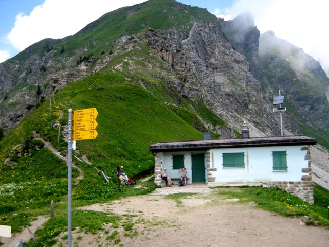
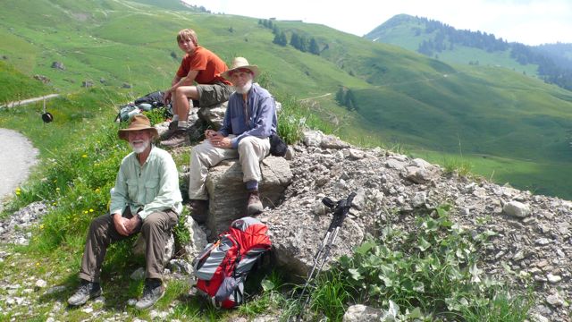
First thing after breakfast, then, was a visit to the Tourist Bureau, where we reserved for the next two nights: tomorrow at les Contamines, in the Hotel Grizzli, recommended by an English woman who ran walking tours; next night at the Refuge de la Croix-Bonhomme. Outside the tourist office was a huge chess set, its pieces perhaps three feet high; Henry and I enjoyed a game, then went to lunch — omelette fines herbes for me.
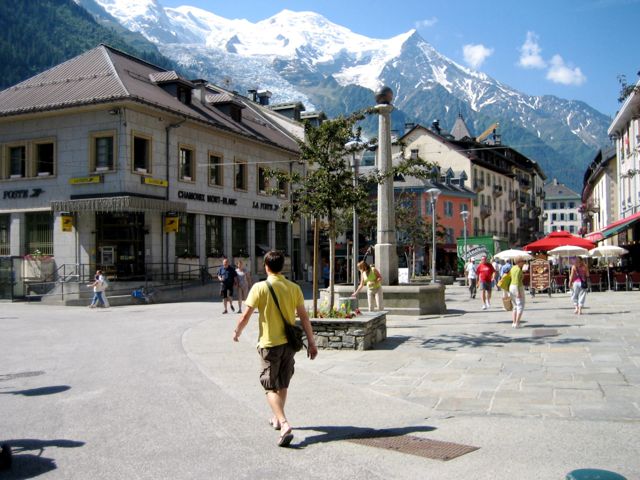
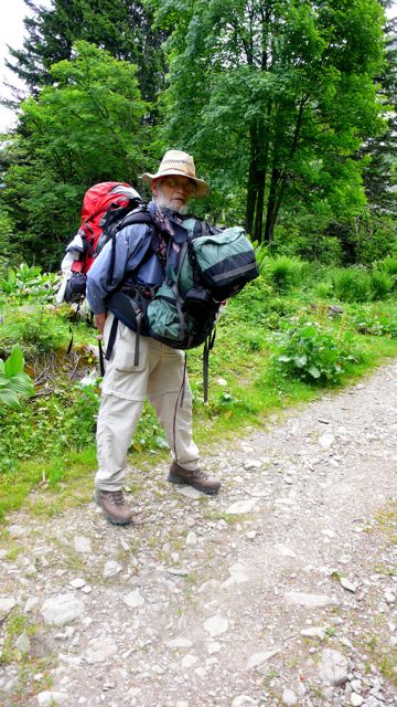
IMG_0187.jpg
photo: Mac Marshall

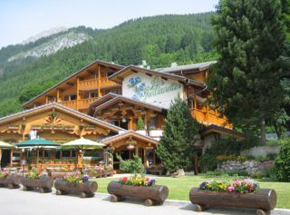
In the afternoon we left our clothes at a laundromat, played a game or two of billiards at the hotel, and did a little shopping — a pair of clip-on sunglasses for me: the snow glare had been tiring. Dinner at a very nice Italian restaurant, La Dolce Vita, where I could rattle away in bad Italian with the proprietor, who was pleased that i was pleased with his food, and eager to talk about it.
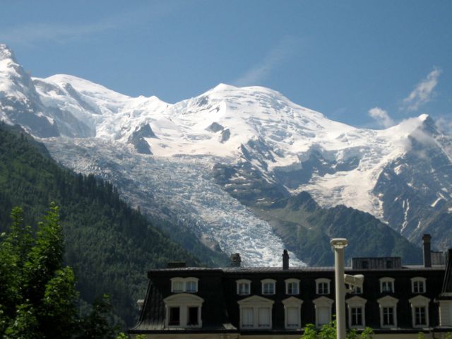
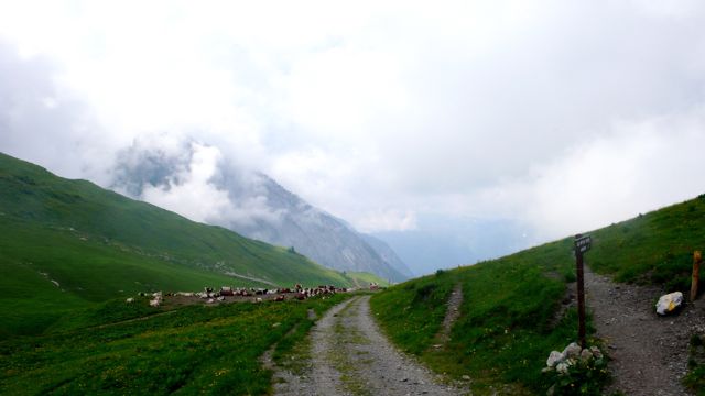
IMG_0188.jpg
photo: Mac Marshall

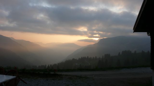
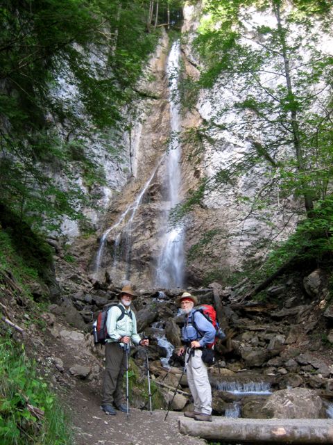
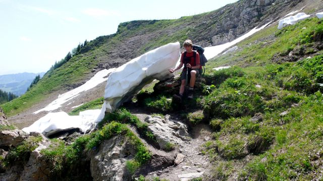
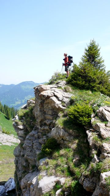
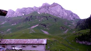
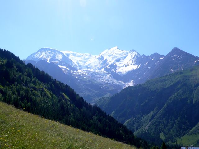
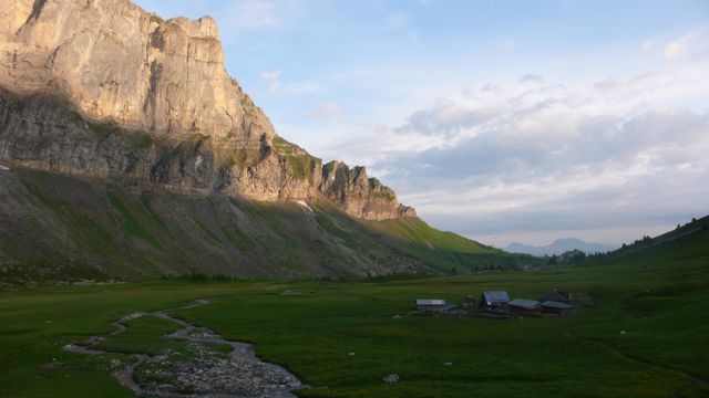
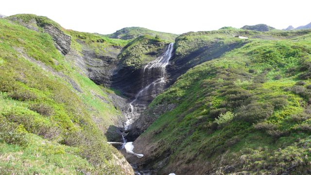
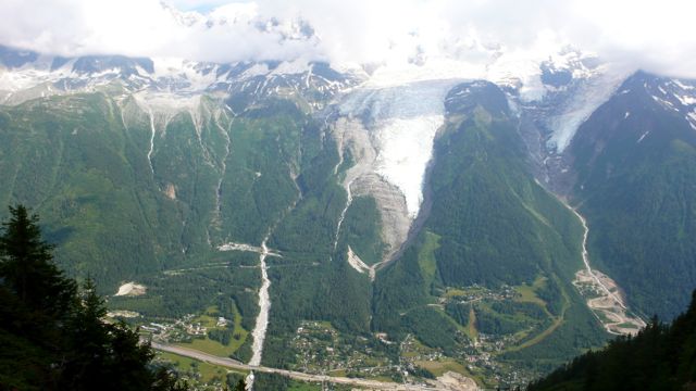
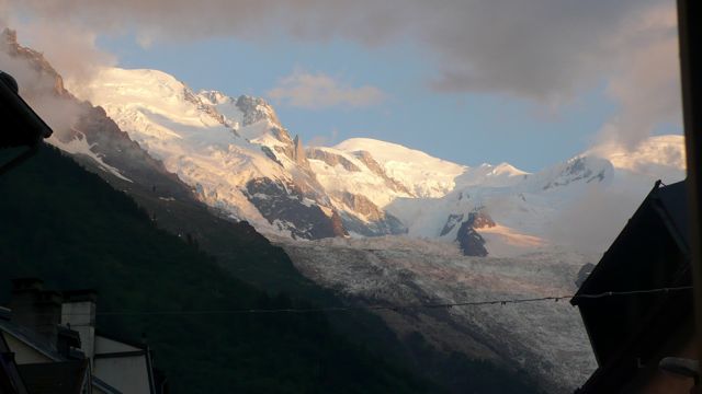
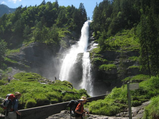
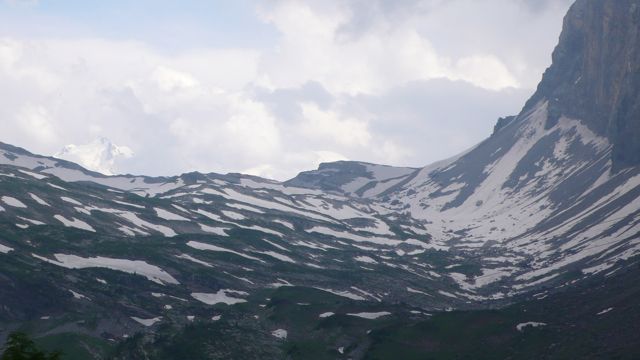
Chamonix is not my favorite French mountain town, but it was more interesting, more fun, more cosmopolitan than I remembered from previous visits. The town was full of Indians, for some reason; their saris lent a surreal note of color. And the scenery outside of town — Mont Blanc and its glaciers, and the Col de Brévent we'd conquered the day before —did a lot to make up for the mishmash of architectural style.
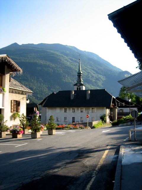
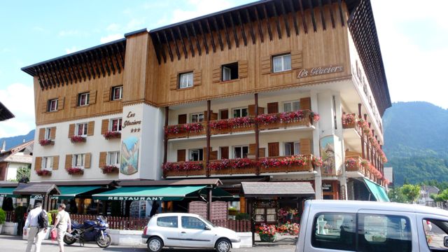
IMG_0191.jpg
photo: Mac Marshall

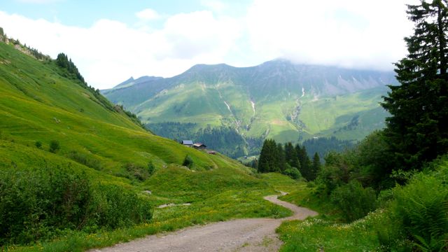
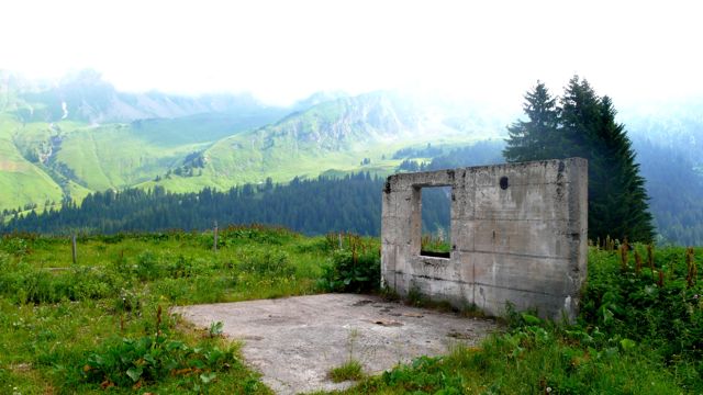
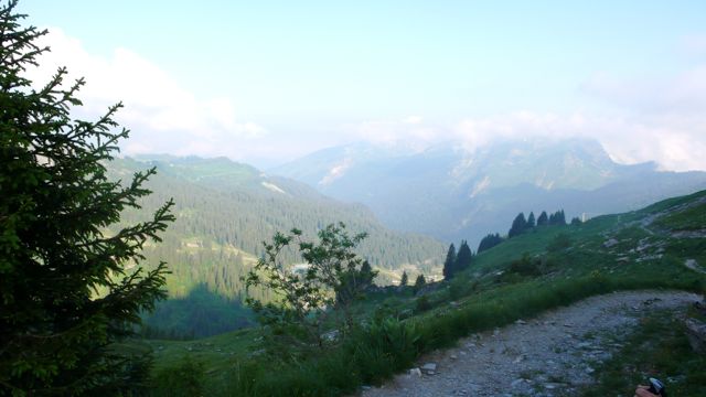
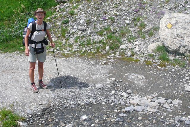
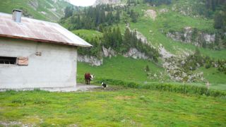
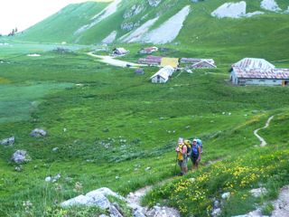
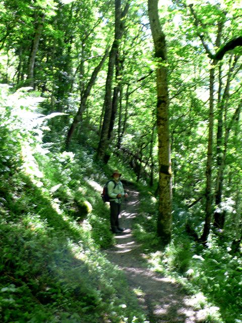
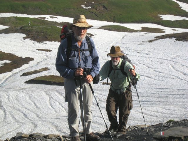
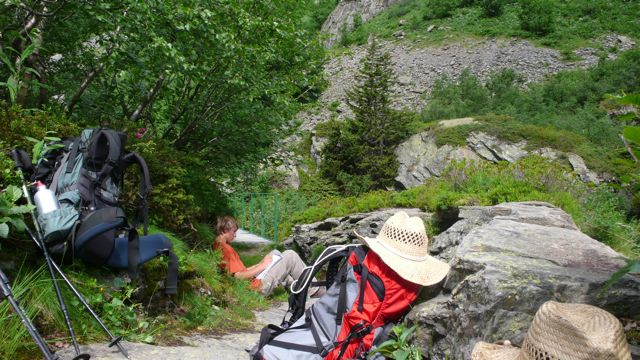
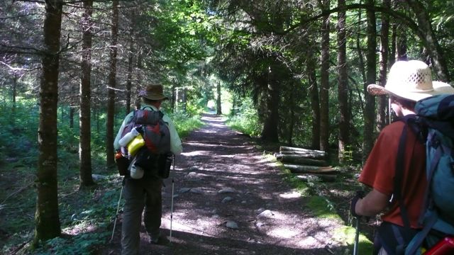
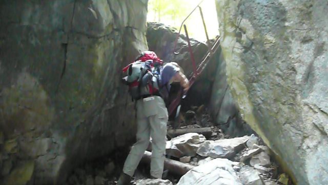
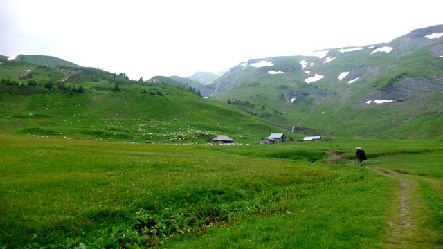
Next morning, July 2, we rose early to catch the 8am bus to les Houches, where we would rejoin the GR5. It's not much more than a wide spot on the road, but there we had our café au lait and croissant in the one café open, bought some apples and chocolate, and set off on a very nice walk uphill, alongside a country road, then a ski lift, through forest, past a World War II bunker, past ruins of stone shepherd's refuges. By about 10 am we'd come to a gîte, Hors Piste, where we topped for tea and conversation with the gardien, a nice guy, conversant in Italian and French. We had the place to ourselves, but as we left a bevy of Dutch ramblers looked in, uncertain as to whether the place was open.
P1020438.jpg
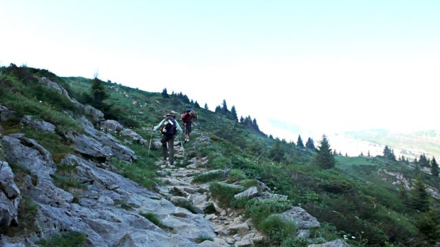
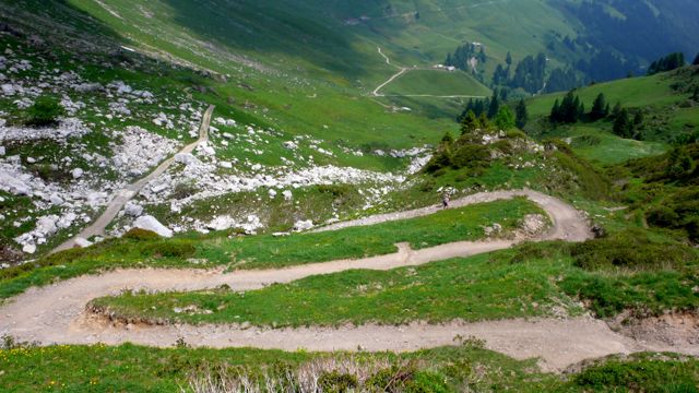
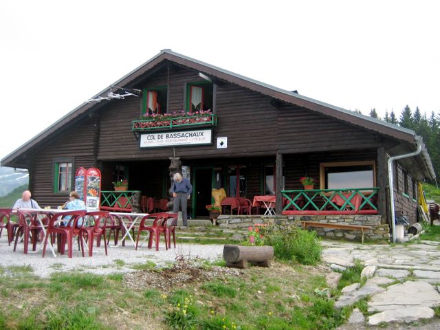
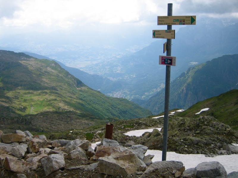
Soon we came to the Col de Voza, the terminus of theski-lift from Les Houches. ("The Girls," as we by now referred to Suzanne Margolis and Ginger Harmon, whose Walking Europe from Top to Bottom (1986: Sierra Club) had inspired me to take this long walk, had taken that ski-lift, one of what we suspected may have been a number of short-cuts they'd resorted to. (Another had been the skilift from Le Brévent down to Chamonix: it was not running the afternoon we'd made that hard descent, two days earlier.)
P1020441.jpg
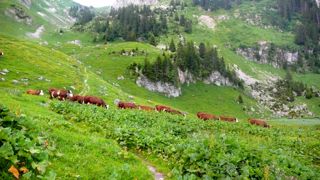
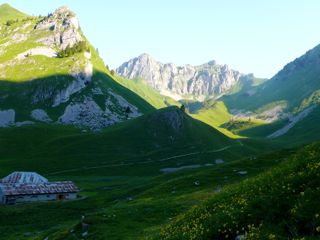
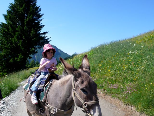
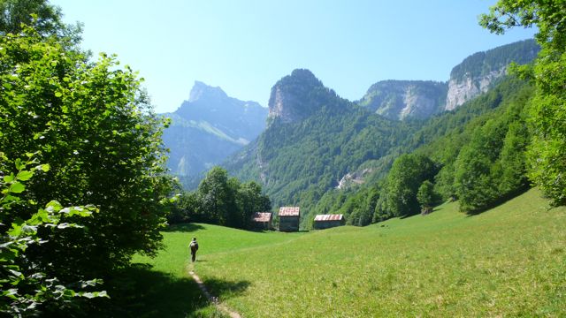
The Col featured a huge hotel, a corral of rental donkeys, and an excursion tram! Lazier folk than we took advantage of these amenities, but we turned away from all that, admired the view ahead of us, and rambled on down to Biomassay, a pretty little hamlet, and at about noon in to the village of Champel, where we found delicious cherries hanging from branches above our path.
P1020447.jpg
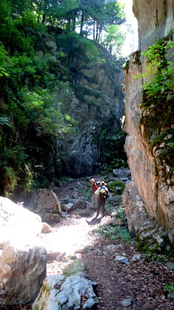
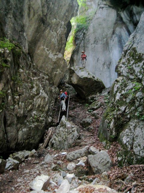
Then came fine walking through forest, and afterward rather a boring walk through vacation villages and the fields separating them. In Gruvaz we admired a fine old school building, where a vacationing couple sunned themselves in the doorway: "How old is the building," I asked; "Aucune idée," came the bored reply.
P1020449.jpg
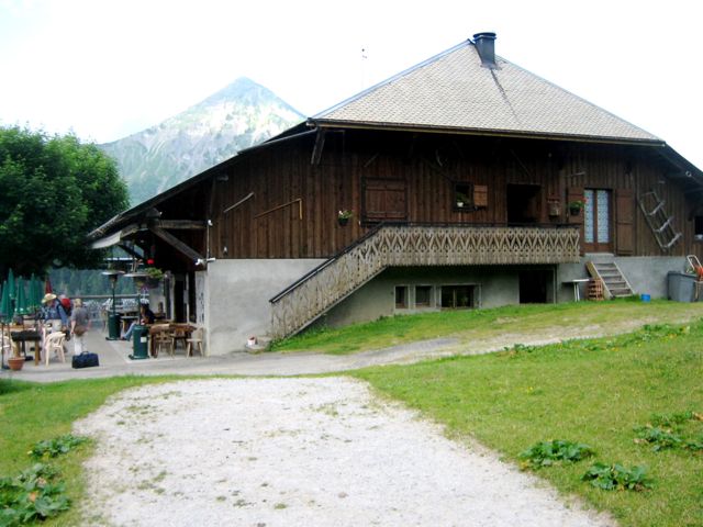
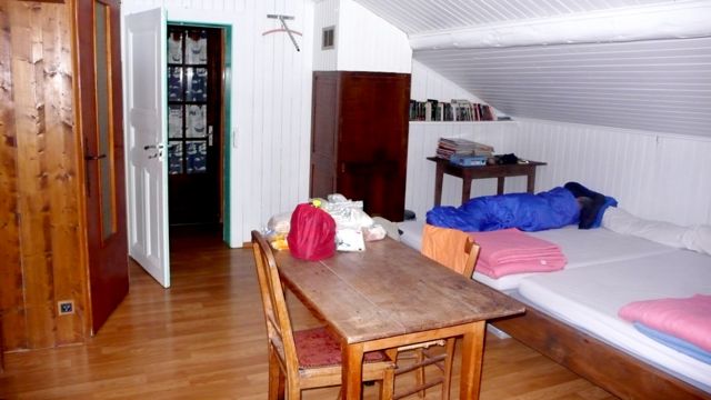
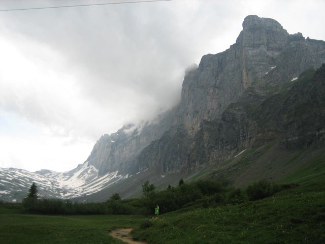
Then suddenly it was hard going down to and back up from the Bonnant (bon nant, good freshet), ultimately to find, at a bench occupied by a sweet old couple, a footpath leading up to Les Contaimnes, where at 3:20 we found the Hotel Grizzli, tourism, a company of Japanese tourists walking the Tour de Mont Blanc, boissons, a mediocre dinner, and a good night's sleep.


Distance walked, day 10: ca. 17 kilometers (10.5 miles). • Time: ca. 7 hours • dénivelément: ca. 1950 meters (6300 feet)

all photos cs except where noted

9 Chalets d'Anterne to Chamonix

Day 11, June 30, 2008—

THIS WAS A VERY TOUGH DAY. By the time it was over, in fact, I was worried we might not get to Nice, not on foot anyway. P1020370.jpg
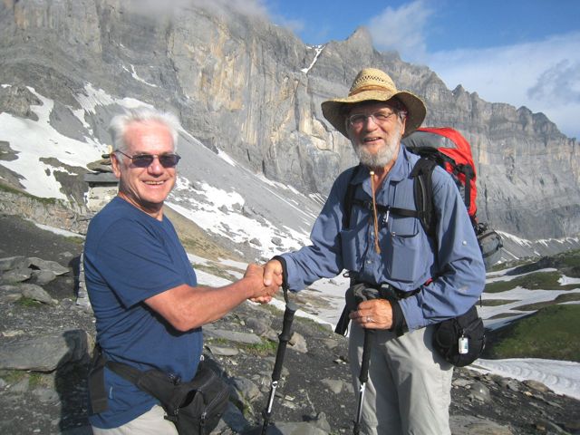
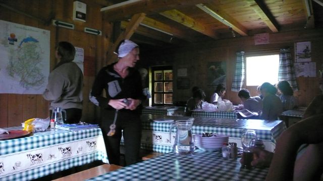
But it began very gently: I woke early, awakened by shepherds incomprehensibly rallying their dogs to move the sheep; and at six we had a very early breakfast, having made arrangements the previous evening: black coffee out of a thermos, cold milk, bread, good cherry jam, and a cake of some kind. We were joined by the three French we'd met the previous day, one of whom turned out to be Swedish.
P1020374.jpg
We left the refuge at 6:37 (!), walking up through alpage toward the Col d'Anterne, crossing a few snowfields; in an hour we'd reached Lac d'Anterne, small but beautiful. From there it was another hour to the Col, elevation 2257 m. (7300 feet) at 8.30 am on fine morning - nearly 2 hours of ascent, 1-1/2 by the book: but we'd rested occasionally en route. thonon les houches 391.jpg
photo: Annie Autier

Our french friends had beat us to the col, and Annie photographed us as we arrived — she explained that when she saw me, "There's my husband, in twenty years," she thought. He'll have to grow a beard.
thonon les houches 393.jpg
photo: Annie Autier


We rested at the Col a bit, but it was soon time to get on. We descended, again across snow at times — and I fell twice — but also across fields of rhododenrons, often seeing cascades nearby.

P1020397.jpg
We found the French again at the Refuge de Moëde, forty minutes later, where we had coffee and a Twinkie-like (though not filled) cake, something like the one we'd had at breakfast. A regional specialty, perhaps. Here we rested a good half hour: then down a steep, often wet stony trail to Pont d'Arlevé, v. picturesque, bottom of steep-sided valley. Another rest: it felt good to lie on cool stone in the warm sun.
P1020410.jpg

Concerned about us, our French friends had waited for us at the Pont. After a 20-minute rest we followed them on a very difficult climb to the Col du Brévent, at 2370 m. the highest point we'd reached so far. The French had already left; in their place we found a troop of french walkers with their guide, doing the Tour des Dents.

IMG_0183_2.jpg
photo: Mac Marshall

It was cold and windy, and already 3.10 — we were three hours behind the book, and had no certain place to sleep tonight. On, then; down, then, to the Refuge at Bel Lachat, where that troop & our French friends were staying: but there was no room for us. We rested half an hour, then left (to applause from the French for les Californiens!) and took the long, hard, stony descent toward the next programmed stop, Les Houches, a village on the southern outskirts of Chamonix.
P1020421.jpg
Mont Blanc beyond Chamonix, a long way down


We turned off the route, though, at the Merlat animal park, arriving about 6.30. The park was just closing. The taxi phone number in my guidebook was unproductive. We walked down to a parking lot, where a local was reading a magazine in his parked car: he was sympathetic, but unable to help. Then a ramshackle van drove up filled with sound equipment and three young guys from Liverpool. They drove us further down to a main road, the Route de Coupeau; then we walked — downhill, bien sûr! —to a gîte. Our bad luck held: it was not yet open: but they called a cab & we drove in to Chamonix, to a newish, cheapish hotel the cabbie recommended, the Auberge du Manoir. Shower, change, and walk into town for dinner: salad Niçoise, with potatoes; and then back to the hotel and to sleep at 10.30 or 11. P1020423.jpg
Mont Blanc glacier from Chamonix, 9 pm


Distance walked, day 10: ca. 20 kilometers (12.5 miles). • Time: ca. 12 hours • dénivelément: ca. 2500 meters (8,100 feet!)

all photos cs except where noted

Monday, August 25, 2008

8 Samoëns to Chalets d'Anterne

Day 10, June 29, 2008—

APART FROM THE WALK to Dent d'Oche on day 2, this was the most strenuous day yet, in spite of a deceptively pleasant stroll at the beginning.P1020318.jpg
We left Samoëns after a hotel-buffet breakfast of eggs and granola — better not get used to that! — about 8:30, walking alongside the Clévieux, rather a broad, easy-going stream, alongside a recreational park. When we came to the faster, fuller Giffre, though, we unaccountably turned right instead of left, walking a couple of kilometers out of our way, passing a couple of middle-aged locals with an ugly dog in both directions: they must have wondered why three men with backpacks were out for a morning stroll!

Finally we got straightend out and strolled in fact along a country road up the Giffre valley, finally coming to the gorge which was the glacial-age bed of the Giffre, a startling stony canyon.
P1020321.jpg
This was perhaps the most spectacular closed scenery of the Long Walk to date, mute and ancient, far from anything humanly commercial or industrious. Our pace slowed because of the stony terrain and the climb, but even more, I think, because of the looming walls, the stillness, the sense of huge spans of time. Places like this have a hypnotic effect; they always seem like gateways to a past which, however remote, feels intimately connected to one's true center of being.
IMG_0156.jpg
photo: Mac Marshall
.
P1020325.jpg
At its upper end the gorge is closed by solid rock cliffs made passable by a series of cables and steel staircase-ladders. On climbing the last of these we came out into a peaceful forested valley, broader, perched high above the present course of the Giffre very far below. Here ancient nature ignorant of humanity gives way to agriculture; the valley is set about with farm buildings and the fields are beautifully grazed, while above the dents and pics and falaises testify to the glacial activity that left these pastures behind.
P1020330.jpg
We took a break to reflect on these matters and more especially to eat our apples, then continued: we had a long climb ahead. We hesitated at the cascade du Rouget, then plunged into forest on a difficult stony trail on which we ultimately lost our way for a while, improvising an emergence IMG_0158.jpg
photo: Mac Marshall
to an even more spectacular set of waterfalls, a national monument with an accompanying café where we rest for an hour with crèpes and salads.
The weather was threatening, though, and we had more distance to cover, and there was snow on the ground ahead, at the collet d'Anterne. IMG_0163.jpg
photo: Mac Marshall


P1020345.jpg
By the time we reached this ridge it was raining hard: time to cover the packs, then ourselves. In two hours, though, we reached our goal: the rain had let up; the pastures were incandescently green; sheep grazed the hillsides, and the low Chalets d'Anterne were ahead of us.
P1020346.jpg
We stayed at the Refuge Alfred Wills, which occupies the house that pioneering alpinist built for his home in the 19th century. Here we joined a few French randonneurs for a delicious nettle soup and… what? the only main course we've failed to recall: we must have been tired.P1020348.jpg 
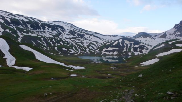
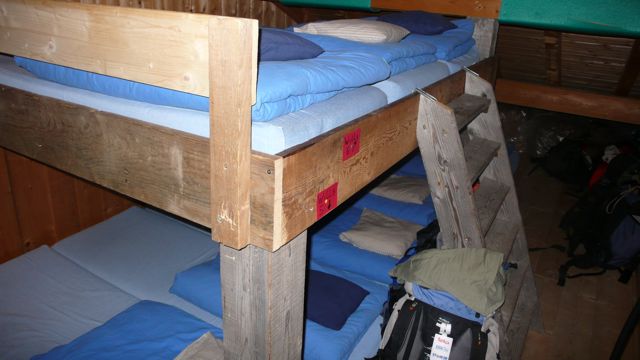
We were early to bed.P1020353.jpg


Distance walked, day 10: ca. 16 kilometers. • Time: ca. 8 hours 45 minutes • ascent: ca. 1200 meters

all photos cs except where noted

Thursday, August 21, 2008

7 Mines d'Or to Samoëns

Day 8-9, June 27-8, 2008—
IMG_0130.jpg
Our gite d'etape at Mines d'Or (photo: Mac Marshall)

This was a tough day, not because of the distance or terrain, not because of altitude or weather, but because of indisposition. We'd got up for an early start, but one of us had what Mac says the Australian aboriginals call a "wog," though I must say this confused me at the time and confuses me more at this distance, as that word, to me, is disrespectful British slang for "non-Caucasian," being the acronym, as I learned sixty years ago, for white Oriental gentleman. Wikipedia calls this a "backronym, but goes on to gloss the word in the sense in which Mac used it, and we adopted the word in that sense during the rest of our walk: it came in handy a number of times.

Anyhow, one of us had a wog, and it wasn't me; but I knew what to do: administer a small dose of Fernet Branca and a Pepto-Bismol. This had the nearly immediate effect of correcting the affected stomach, and after breakfast we got under way at nine o'clock, walking down a paved road, then up a stony one. It was a fine clear morning filled with birdsong and cowbells, but the wog dogged our steps. P1020272.jpg
photo: cs
By 9:45 we had to stop for a long rest, near a curiously abandoned hut-in-the-making.P1020267.jpg
photo: cs

Before long I was carrying two packs, mine on my back, another on my chest — each weighing maybe ten or twelve kilos. This wasn't fun, but paid me back for my inattentiveness last night, when I should have watched the gnôle intake a little more closely. This particular wog was nothing but a classic hangover.P1020271.jpg
photo: Mac Marshall
We soldiered on, though, reaching the col de la Golèse (1660 meters) by 10:30, in weather that had begun to turn cold and misty.P1020275.jpg
photo: cs
In another two hours — our guidebook said it should only have taken one — we reached the hamlet of les Allamands, where we'd hoped to have lunch. Alas the only café was closed for the day. We weren't the only ones disappointed: I noticed a small car drive up past us, two women in the front seat; before long they were coming back toward us.
I didn't hesitate: I stepped out into the road in front of the car, raising my hand in what I hoped was a gesture of friendly despair. "My buddy here is very sick, and I don't see how he can walk all the way to Samoëns. Can you give us a ride, if you're going there?"
They good-heartedly made room for two men and two backpacks; the third would have to keep walking.
We were let off in the heart of Samoëns, where the first person we ran into was our Austrian friend. She was just leaving town; she'd spent the night in a gîte that she recommended, but it wa full and we had to check in at the only hotel. We lost no time checking in, and one of us immediately went to bed.P1020280.jpg
photo: cs

In an hour or so the third party walked in: fortunately we both have mobile phones, and we soon met for a boisson and a walk in the park. The woman who founded the (formerly) great Paris department store La Samaritaine, Marie-Louise Jaÿ, was from Samoëns, and she funded a splendid alpine botanical garden on a hillside above town, where we spent the afternoon. There we found among other things a Sequoiadendron, always a curious sight away from the Sierra but to a Californian a welcome one, even if alongside an ornate Savoyard spire.P1020291.jpg
photo: cs

Distance walked, day 8: ca. 6 kilometers. • Time: ca. 3-1/2 hours • elevation change: ca. 1100 meters
Day 9: rest day

Monday, August 18, 2008

6 Col de Bassachaux to Mines d'Or

Day 7, June 26, 2008—

P1020240.jpg
photo: cs

Another quiet night of solid, sound sleep; then up at 5:45 to cool, low mists. We left right after breakfast, at 7:30, and reached the col de Chésery 90 minutes later and 200 meters higher, having climbed easily along a dirt road;
P1020242.jpg
photo: cs

then up steeper loose stones to the col, at 6525 feet. P1020244.jpg
photo: cs

Along the way the sound of birds, cuckoos hidden among the distant trees. At Chésery, quite a different scene: a team of Swiss women (and one or two men) unloading things from trucks into the chalet-refuge, which would open in a day or two. We had crossed, in fact, into Switzerland.
IMG_0121.jpg
photo: Mac Marshall

Everything was vacuumed as it was unloaded; one woman busily dusted off a couple of apparently brand-new telephone directories. We asked if we might sit at one of the picnic tables to have a snack: "Yes, you may rest, but leave the tables clear, we have to clean them."

This was not amusing and we soon left, walking along the edge of an improbably green alpine lake, then climbing, then descending to Chaux-Palin, where we found a cup of tea and, a little later, a glass of delicious Swiss milk, the first glass of milk I'd had in weeks.

A long pleasant traverse, then the climb 300 meters to the col de Coux: en route, we stopped for lunch (egg, ham, bread, orange, tomato, supplied by last night's refuge) and were photographed
P1020249.jpg
photo: Sabine Schroll
by a handsome athletic woman who walked our way, an Austrian with a lithe frame, a heavy pack, and a wonderful, enthusiastic, strong and competent disposition: I'll have more to say about her later on.
P1020248.jpg
photo: cs


At the col, conversation with a couple of English walkers; then an easy descent on switchbacks, then a straight dirt road, to a crossroads:
P1020255.jpg
photo: cs
which of a number of refuges to choose? The closest, by now: and we took a difficult descent through rough pasture, often lacking trail, to les Mines d'Or, where we arrived at 2:45, too late for lunch, far to early for dinner.

French fries, we all cried for, and a huge bowl arrived with the salt we craved, and bottles of Badoit (I added drops of Fernet to mine); and then showers, and a stroll around a trout pond, and a game of boules.

It's called "Mines d'Or" because in fact the mountainside above the hotel was mined centuries ago; you can still see openings to mines. The gite is really more an old-fashioned hotel: we had a nice room to ourselves, with an armoire and a balcony; the wc was down the hall,
P1020259.jpg
photo: cs

and the dinner wasn't bad: gazpacho, poulet Basquaise, watermelon with "red fruit," and, as a digestive, a delicious pastique.made with local gnole, a rough Savoyard version of grappa smoothed with sugar and mountain herbs. Sleep came easy.

Distance walked, day 6: ca. 20 kilometers. • Time: ca. 7 hours 15 minutes • elevation change: ca. 1500 meters

5 la Chapelle d'Abondance to Col de Bassachaux

Day 6, June 25, 2008—


We left the hotel at 8:15, stopping at the ATM and to fill our waterbottles at a bar with a very pretty bargirl. We followed the Torrent des Mattes, admiring its cascade,
IMG_0091.jpg
photo: Henry Shere


climbed through forest through Sur-Bayard and up lacets — switchbacks — across fields; then easier climbs back in forest again.
IMG_0094.jpg
photo: Mac Marshall


We reached the Chalet des Crottes after two and a half hours, stopping for conversation with a herd of French tourists and their guide; then through open flowery and sometimes marshy fields to another chalet or two and then, in snowy weather, arrived at the col des Mattes, today's highest point at 1930 meters, at 12:15.
P1020208.jpg
photo: cs


There we ducked under a fence, tricky with a backpack on, admired the view,
P1020210.jpg

photo: cs

and then set off down more lacets, down over 200 meters through pastures. These switchbacks ease the grade, of course, but make problematic any estimate of horizontal distance covered, which is why you must take statistics at the bottom of these pages with a grain of salt: I try in general to underestimate.

The Chalet de l'Etrye was closed, of course — no provisions here but a few apples we'd brought with us. We took a country road to Lenlevay, where we could refill our canteens; then a harder climb up 150 meters the arête de Coincon, and then across generally open country, down 200 meters and back up another hundred, to the fine gite
IMG_0101.jpg
photo: Mac Marshall

P1020236.jpg
photo: cs


at the Col de Bassachaux, where for dinner we had potage, tartaflette, and a delicious tarte à myrtilles, washed down with Apremont.
P1020231.jpg
photo: cs


Distance walked, day 6: ca. 16 kilometers. • Time: ca. 7 hours 30 minutes • elevation change: ca. 1600 meters

4 Chalets de Bise to la Chapelle d’Abondance

Day 4 & 5, June 23, 24—
P1020119.jpg

Up at 5:30 to watch the dawn and the cows coming in to be milked, P1020121.jpg

one milker helped by three dogs, one of whom was apparently being trained by the other two. P1020122.jpg

First sun on mountaintops to the west. A fine morning, not a trace of the predicted rainstorm.

A fairly easy climb for an hour or so from Bise to the Pas de la Bosse, gaining 300 meters, P1020128.jpg

the valley beautiful behind us; ahead,

P1020130.jpg

the stone walls of the mountain changing as we neared. Then a fine Col, and an easy descent to the Chalet-laiterie, closed unfortunately (as all seem to be). But then, after passing a ruined transhumance refuge,

P1020144.jpg

we lost our way somehow and had to "bushwhack" through rough brushy vegetation hiding marmot-holes. Ultimately we regain the track, but it's a steep, stony, challenging one through forest.

Then, at the bottom, another kind of disappointment: civilization. Big tracts are being "developed," apparently for more timeshare leisure residences. We hurry past and find a "discovery route," a nice footpath leading past explanatory panels describing the flora, fauna, and history of the area.

This leads to the town of la Chapelle d’Abondance, where, tired, we simply fell into the first hotel we saw — too grand a hotel for me, with an indoor swimming pool and a theme-park decor, but pleasant enough for our first recuperation.

IMG_0087.jpg
photo: Mac Marshall (other photos: cs)


And we could select our meals from menus! Lunch was trout, tomato, fennel, and potatos; dinner was pintadeau — guinea fowl, a favorite of mine — with the Canadians, who'd booked a nearby gite.

We decided to stay here an extra day. Chef drove us to a supermarket a couple of miles away, where we replaced our lost straw hats and water-bottles; then, to stay in shape, we walked back. That night we enjoyed a “traditional” dinner: mountain salad with lettuces, lardons, and hardcooked eggs; and sliced dry ham; and boiled potatoes to dip into your fondue; and best of all pickled sour cherries with tiny mushrooms, served in a downstairs dining room done up in traditional chalet style.

Distance walked, day 4: ca. 10 kilometers. • Time: ca. 4 hours • elevation change: ca. 1100 meters
Day 5: rest day